
GIS Days 2020
Virtual Event
GIS Day goes virtual
Celebrate Geographic Information Systems (GIS) Day alongside community leaders at this free, virtual, interactive event.
Not technical? That's okay, maps and mapping technology are more accessible now than ever before.
All sessions are in Eastern Standard Time (EST). Links to attend sessions are in the schedule. Unless required registration is indicated, sessions are open for participation without signing up.
It's your chance to:
- Escape into new virtual reality worlds
- Discover how to take advantage of mapping technology in your research, education, or for your next job interview
- Draw for one of four gift cards
Join us the evening of Nov. 18th for a geography-themed trivia event. Lots of prizes up for grabs All are welcome.
Event collaborators
- Brock University Maps, Data and GIS / Digital Scholarship Lab
- Carleton University Library
- Queen’s University Library
- Trent University Library and Archives, Maps, Data and Government Information Centre
- Bibliothèque de l'Université d'Ottawa | University of Ottawa Library
- University of Waterloo, Geospatial Centre and Faculty of Environment
- Western University, Department of Geography and Environment
Schedule
Visit our interactive map-based program for information about individual presenters and presentations.
Monday Nov. 16
Lightning talk session, 10 a.m.
Duration: 45 minutes (7 minutes per presentation)
Theme: The natural earth
- How a Kiwi surveyor ends up doing GIS in Scotland – Craig MacDonell, University of Glasgow
- Data fusion approaches for studying geomagnetic navigation in migratory animals – Jed Long, Western Geography and Environment
- The impact of climate change on Canadian archives – Amanda Oliver, Western Libraries
Demonstration session, 11 a.m.
Duration: 1 hour (20 minutes per presentation)
- Navigating Scholars GeoPortal – Amber Leahey, Scholars Portal
- Drones in libraries: The development of an interdisciplinary research service using drones and 3D modelling techniques – Dan Jakubek, Ryerson University
Networking session, 12:30 p.m.
Duration: 1 hour
Drop in and chat with your peers, discuss the morning’s sessions and network virtually with attendees.
Special demonstration, 2 p.m.
Duration: 1 hour
The geography of Pokémon Go – Vivian Kong, Western University
Lightning talk session, 3 p.m.
Duration: 45 minutes (7 minutes per presentation)
Theme: GIS at the conservation authority
- Using ArcGIS Collector and Dashboards for agricultural windshield surveys – Tom Dufour, Essex Region Conservation Authority
- How UTRCA has used Provincial Lidar DTM (Open Data) in 3 ways – Terry Chapman, Upper Thames River Conservation Authority
- Using Lidar DTM for hydrology – Collin Branton, Upper Thames River Conservation Authority
- Lidar DEM to Contours... I’ll just click this – Philip Simm, Upper Thames River Conservation Authority
Tuesday Nov. 17
Lightning talk session, 10 a.m.
Duration: 45 minutes (7 minutes per presentation)
Theme: GIS and libraries
- Using GIS data to find and extract locations in historic texts – Rebecca Bartlett, Carleton University
- Follow me closely: Developing a plan for digital preservation of GIS data – Veronica Berry and Leanne Olson, Western Libraries
- Where “To be, or not to be”: 150 Years of Shakespeare in Ottawa– René Duplain and Roxanne Lafleur, University of Ottawa
- Historical GIS and virtual environments for immersive gamed pedagogy – Zack Macdonald, St. Jerome’s University
- Nitrate contamination within groundwater: Using GIS to identify spatial patterns and relationships to land use/land cover – Michael Schmidt, Trent University
Demonstration session, 11 a.m.
Duration: 1 hour (20 minutes per presentation)
- Getting started with Story Maps – Catherine-Anne Currie, Western Libraries
- Building an open data site – Nolan Frew, Western Libraries
Networking session: Esri Canada Centres of Excellence (ECCE), 12:30 p.m.
Duration: 1 hour
Drop in and chat with ECCE student associates and directors about the program.
Session includes:
- 2020-2021 ECCE activities and GIS Certificate program – Kathy Tang, Western Geography and Environment
- An ECCE research collaboration example: GIS application in urban flooding analysis – Jinfei Wang, Western Geography and Environment
- Resources for web app development with ArcGIS – Dr. Michael Leahy, Esri Canada
- Randomizing GPS tracking trajectories to model social structure in feral swine – Jack Mcilraith, ECCE Student Associate, Western Geography and Environment
- Problem-based learning in GIS – Heather Peacock, previous ECCE Student Associate, Western Geography and Environment
Demonstration session, 2 p.m.
Duration: 45 minutes
- A brief introduction to QGIS – Martin Chandler, McGill University
- You CAN Handle the Truth... and Reconciliation! Decolonizing your world with maps – Francine Berish, Queens University
Lightning talk session, 3 p.m.
Duration: 45 minutes (7 minutes per presentation)
Theme: History and GIS, presented by the Huron Community History Centre
- Hidden histories of Southwestern Ontario – Tom Peace, Huron University College
- Mapping the Loyalist migrations – Tim Compeau and Natalie Boros, Huron University College
- Reporting on the Demarest Rescue – Ben Harris, Huron University College
- Insulin 100: Sir Frederick Banting – Scott Smalley, Huron University College/Defining Moments Canada
Wednesday Nov. 18
Lightning talk session, 10 a.m.
Duration: 45 minutes (7 minutes per presentation)
Theme: Mapping COVID-19 using GIS applications
- Using Survey123 and Portal for ArcGIS to manage a large team for COVID-19 economic recovery research – AJ Wray, HEAL Lab, Western Geography and Environment
- Scaling back: Mapping restrictive public health measures – Tom Petrella, Western Law
- Story maps, web apps and mobile apps to safely deliver a field-based course during COVID-19 – Marikka Williams, Fleming College
Hands-on tutorial, 11 a.m.
Duration: 1 hour
Introduction to ArcGIS Online (Classic) – Sharon Janzen, Brock University
How to find your first Geospatial job, 12:30 p.m.
Duration: 1 hour
Presented by Jonathan Murphy, GoGeomatics Canada
Hands-on tutorial, 2 p.m.
Duration: 1 hour
Collector for ArcGIS – Meaghan Kenny, Carleton University
Lightning talk session, 3 p.m.
Duration: 45 minutes (7 minutes per presentation)
- Girls don’t go: A geospatial analysis of mobility in the Emergency Medicine Residency match by gender – Caroline Kayko, University of Michigan Library
- GPS in GIS: Merging tracks into spatial objects for analysis – Malcolm Little, HEAL Lab, Western Geography and Environment
- Mapping Canada’s tornadoes – Aaron Jaffe, Western University
- Contribute to an open source web mapping project – Al Proulx, County of Simcoe
Trivia event, 7:30 p.m.
Duration: 3 hours (approx.)
- Twitch livestream presented by Elizabeth Jewlal, Western University
- Play with friends and colleagues using Trivia Discord for a chance to win prizes
Thursday Nov. 19
Lightning talk session, 10 a.m.
Duration: 45 minutes (7 minutes per presentation)
Theme: Spatial ecology
- Landscape connectivity among island-dwelling caribou – Debbie Jenkins, Trent University
- Estimating the density and distribution of wild turkeys across Ontario – Jennifer Baici, Trent University
- Identifying suitable habitat and movement corridors for a species of salamander on Pelee Island – Graeme Smith, Trent University
- Creating a richness-risk index for conservation prioritization – Heather Peacock, Western Geography and Environment
Demonstration session, 11 a.m.
Duration: 30 minutes (20 minutes per presentation)
Data transformation and geo-location of historical Vernon directories – Eva Dodsworth and Markus Wieland, University of Waterloo
London GIS Working Group Open Meeting, 1:30 p.m.
Duration: 1 hour
Drop in to hear from GIS professionals about their current and ongoing projects. The group meets once a quarter to discuss GIS projects and initiatives across the city. Contact Liz Sutherland for details.
Lightning talk session, 3 p.m.
Duration: 45 minutes (7 minutes per presentation)
- Utility of hyper-resolution Lidar as a tool for planetary geomorphology in the Canadian High Arctic – Chimira Andres, European Space Agency
- Utility GIS in action: Sarnia oversized load corridor – Aiden Poole, Bluewater Power Distribution Corporation
- Estimating yield of household groundnut fields in rural smallholder farming systems and its implication for food security – Daniel Kpienbaareh, Western University
- Geospatial data collection for agriculture research – Jody Yu, Western University
- GIS applications in Astronomy – Robin Kwik, Western University
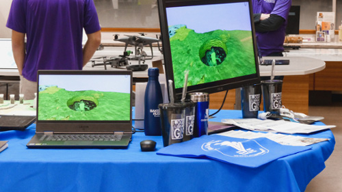
Look back at GIS Day 2019
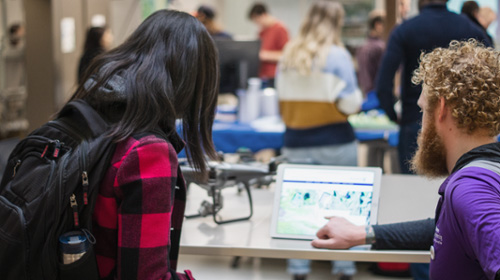
Northern Tornadoes Project engineer, Connell, shows off high-resolution drone imagery.
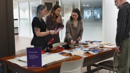
Library co-op students make custom map button crafts.
The OGSR Library showcase their virtual reality demonstration of Ontario geology.
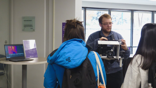
The Department of Geography and Environment demonstrate their research equipment.
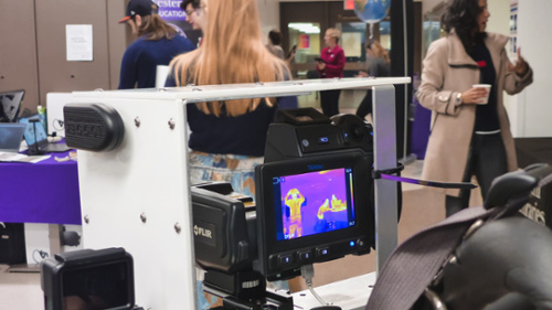
Austine shows students how the thermal camera is used in his research on urban climates.
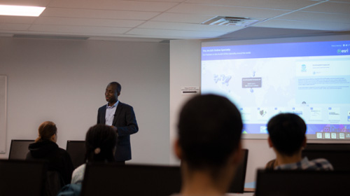
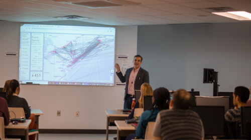
James shares his GIS journey during his lightning talk.
Alex describes the different types of rock found in southwestern Ontario.
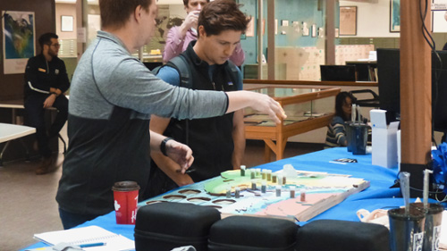
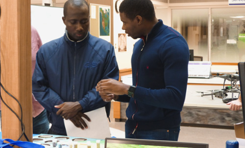
Craig shows Dan how he maps Ontario's geology.
Tim shares his research mapping loyalist migrations.
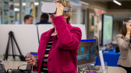
Jo explores virtual reality.
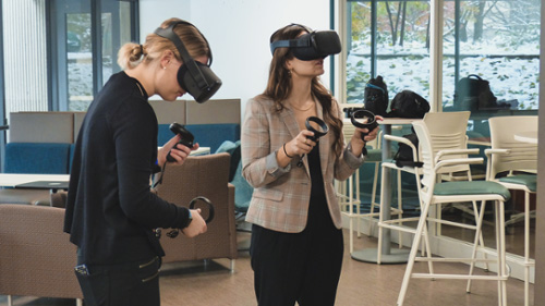
Sydney shares the virtual reality applications used by Dillon Consulting.
Photo and video consent
Western Libraries will be shooting photos and video at this event to be used for future promotional purposes related to Western Libraries, Western University, and our events. By attending this event, attendees consent to their image being used for such purposes. If you have any questions or concerns, please contact Katrina Fortner.