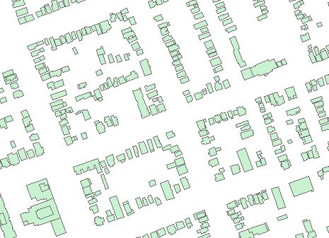
Building Heights - 2012 (RMSI Global Data)
The 2012 building heights data consists of the following geospatial datasets for use in Geographic Information Systems (GIS), or Computer-aided Design (CAD) software programs.
3D Building Height Data
Outline of built-up structures (buildings, houses) with above-ground height values, measured at the top of the roof.
Digital Terrain Model (DTM)
The Digital Terrain Model includes elevations of land and water.
Land Usage (Clutter)
Land use within London classified into seven (7) categories - buildings high, buildings medium, buildings low, parks, vegetation, open, and water.
Satellite Updated Vectors
Boundaries for nine (9) land use features - highways, main roads, other roads, streets, railways, airstrip, lake, river, and coastline.
Places
Points of interest (educational, commercial, industrial, public spaces, etc.) within London.
Projection
Coordinate system: UTM - NAD'83, 6° projection, Zone 17.
Central Meridian 81° West.
Location
Library Call Number: GD.CA.01.1
Restrictions on Access / Use
This resource is available to University of Western students, faculty and staff for academic, research or personal reasons. RMSI Global Data should be cited in any maps or graphics generated. Patrons will be required to sign a release form when requesting the data. Data must be requested in person at the Map and Data Centre Reference desk.
Sample View of the Data
Downtown - London, Ontario - 1:5,000

Sample Citation
London 3D Building Data Package [computer file]. RMSI Global, Noida, India, 2012.


