
Esri Data and Maps
Esri Data & Maps Media Kit contains many types of spatial data at many scales of geography. Extensive metadata is included with each dataset.
Coordinate system: Geographic (Decimal Degrees) - NAD 83
Source format: Smart Data Compression (SDC), ArcGIS Layer File (LYR), and JPEG2000
Released: 1999, 2001/2002, 2004, 2008, 2010, 2012, 2013, 2014
Regions: North America, Mexico, Europe, World
Available Themes / Layers (Vector Format)
Availability may vary by region and release date.
- Admin Units/Boundaries
- Airports
- Area Codes
- Census Blocks
- Census Feature Class Codes
- Census IPC Demographics
- Census Tracts
- Cities
- Congressional Districts
- Continents
- Contours
- Core Based Statistical Areas
- Countries
- County
- County Population
- Drainage Systems
- Ferries
- Gazeteer
- Geographic Names
- Highways
- Hospitals
- Institutions
- Lakes
- Landmarks
- Latitude/Longitude Grids
- Municipalities
- National Atlas of the U.S.
- National Transportation Atlas
- NUTS Demographics
- Parks/Recreation Areas
- Political Organization Membership
- Populated Places
- Provinces
- Railroads
- Regions
- Retail Centres
- Rivers
- Roads
- State Plane Zones for NAD27
- State Plane Zones for NAD83
- States
- Time Zones
- Transportation Terminals
- Urban Areas
- USGS Topographic Quad Series Index
- UTM Zones
- Water Bodies
- World Map Background
- WWF Marine Ecoregions
- WWF Terrestrial Ecoregions
- Zip Code
Available Themes / Layers (Raster Format)
- Global Digital Elevation Model (SRTM)
- Global Digital Elevation Model (ETOPO2)
- Global Digital Elevation Model (GTOPO30)
- Global Shaded Relief
- Global Imagery 150-Metre Resolution
- World Topography and Bathymetry
- WorldSat Colour Shaded Relief
- World Cloud Free
- World at Night
- World with Clouds
- World with Ice
Restrictions on Access
This resource is available to University of Western Ontario students, faculty and staff for academic (instruction or research) purposes only. Data must be requested in person at the Map and Data Centre Reference desk. Patrons will be required to present a valid UWO ID card and sign a release form when requesting the data.
Data Manipulation / Usage
The Map and Data Centre has GIS workstations equipped with ArcGIS and QGIS to explore/manipulate the data. UWO users may also copy requested resources to a data storage device (ex. USB flash drive) for research or teaching use outside of the library. Esri should be cited in any maps or graphics generated.
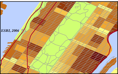
Sample View of the Data
Population by Census Tract around Central Park - New York City, United States
Sample Citation
Esri Data & Maps 10.2 Media Kit [computer file]. Redlands, California: Environmental Systems Research Institute Inc., 2013.