Greater Toronto Area Orthoimagery
The 2005 Colour Digital Orthoimagery of the Greater Toronto Area (GTA) is divided in 35 compressed aerial photo MrSID mosaics at a spatial resolution of 20cm. The file sizes range from approximately 415mb to 1.99gb. A map has been created to indicate the coverage area. (Coverage includes Durham, Halton, Hamilton, Peel, Toronto and York.)
Coordinate system: UTM - NAD'83, Zone 17.
Aerial photography scale: 1:10,000
Aerial photography date: 2005
Ground pixel resolution: 20cm
Source format: SID 'World'.
Restrictions on Access / Use
This resource is available to University of Western students, faculty and staff for academic, research or personal reasons. J. D. Barnes First Base Solutions and the Ontario Ministry of Natural Resources should be cited in any maps or graphics generated. Patrons will be required to sign a release form when requesting the data. Data must be requested in person at the Map and Data Centre Reference desk.
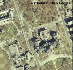
Sample View of the Data
Orthoimage sample of Queen's Park - Toronto, Ontario