South Western Ontario Orthoimagery Project (SWOOP)
The South Western Ontario Orthoimagery Project (SWOOP) is a joint effort between Lambton County, Land Information Ontario, and a number of other partners to capture high resolution digital orthoimagery of approximately 42,000 square kilometres of land in Southwestern Ontario. SWOOP is one of the largest orthophotography projects in North America. More information about SWOOP can be found at the Scholars GeoPortal website.
The following counties are available at the Map and Data Centre. Click the links for detailed index maps of each.
- Brant - West Index* | East Index*
- Bruce - Southwest Index | Southeast Index | North Peninsula | South Peninsula
- Chatham-Kent - West Index | East Index
- Dufferin - West Index
- Elgin - West Index | East Index
- Essex - West Index | East Index | Pelee Island Index
- Grey - Northwest Index | Northeast Index | Southwest Index | Southeast Index
- Haldimand - Index
- Huron - North Index | Central Index | South Index
- Lambton - North Index | South Index | Walpole Island Index
- Middlesex - North Index | Southwest Index | Southeast Index | City of London Index
- Norfolk - North Index | South Index
- Oxford - North Index* | South Index*
- Perth - North Index* | South Index*
- Waterloo - North Index | South Index
- Wellington - West Index | Central Index | East Index
- * Index created by the University of Waterloo Map Library
The 2006 and 2010 SWOOP Colour Digital Orthoimagery is separated into 1km by 1km MrSID tiles, each at a spatial resolution of 30cm. The average file size is approximately 1.6mb.
Coordinate system: UTM - NAD'83, Zone 17
Aerial photography scale: 1:10,000
Aerial photography date: 2006 and 2010
Ground pixel resolution: 30cm
Source format: SID 'World'
Restrictions on Access
This resource is available to current University of Western Ontario students, faculty, and staff for educational use (research or instruction) only.
Access / Use
This resource is available through the Scholars GeoPortal website (use the Firefox browser for full functionality).
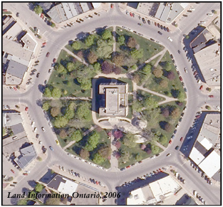
Sample View of the Data
Town Centre - Goderich (Huron County), Ontario