
Aerial Photography County Coverage: 1946 - 1950
The following graphic indicates the air photo coverage (shaded in orange) held in the Map Collection for 1946 to 1950. Specific county coverage details, including scale where available, are provided as well.
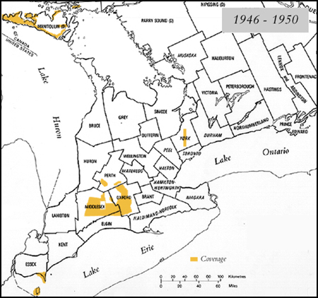
Details
- ESSEX (Point Pelee) 1:16,000 - 1947
- ESSEX (Pelee Island) 1:15,000 - 1947
- MANITOULIN 1:20,000 - 1946
- MIDDLESEX 1:13,000 - 1950
- MIDDLESEX (Medway Creek) 1:6,000 - 1950
- MIDDLESEX (North Thames) 1:20,000 - 1946
- OXFORD 1:6,250 - 1948
- OXFORD 1:12,000 - 1950
- OXFORD (Tavistock) 1:24,000 - 1950
- PERTH 1:5,600 - 1948
- PERTH 1:6,000 - 1950
- YORK 1:20,000 - 1946
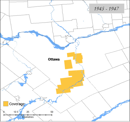
Ottawa Region
- OTTAWA 1:15,000 & 1:20,000 - 1945-47